Project Files & Links
About the Project
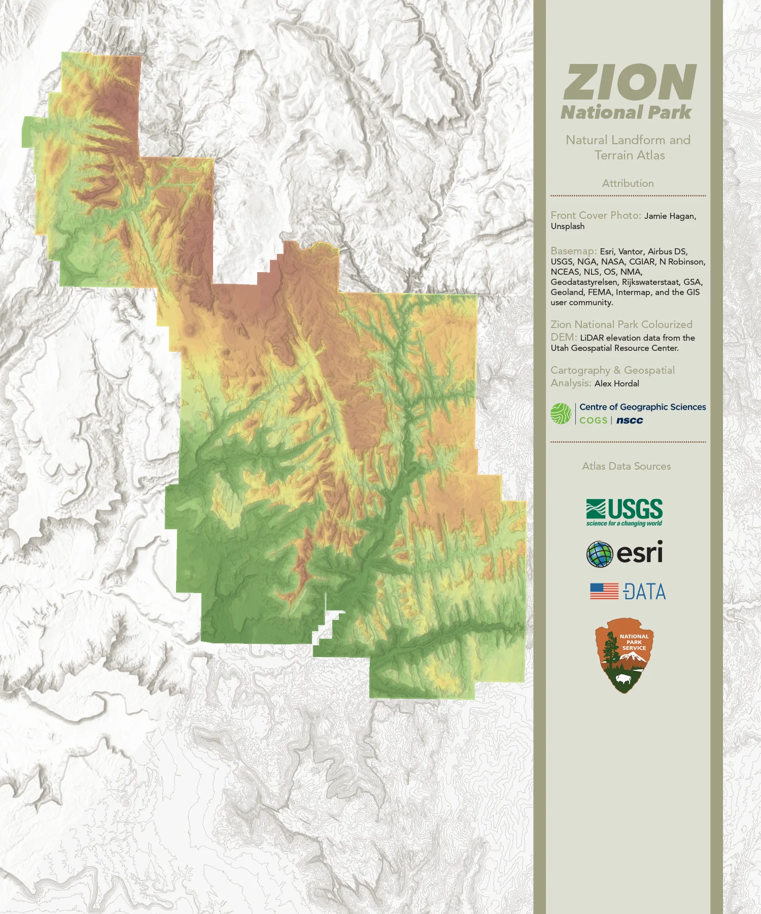
This atlas is a topographical reference of Zion National Park and uses digital elevation models, hill shading, and contour mapping to illustrate the park’s terrain. Its purpose is to provide readers with a detailed visual understanding of Zion’s major landforms, elevation patterns, and spatial relationships.
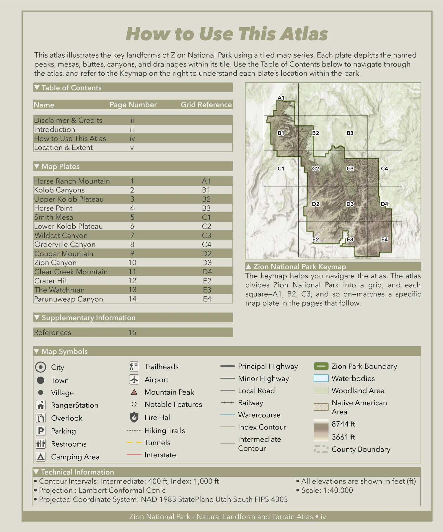
The atlas is divided into 14 map plates, each representing a unique portion of the park. Every plate is identified by a grid designator (see How to Use This Atlas) and titled according to the most prominent features within its extent. Together, the plates present a complete, continuous picture of Zion’s landscape.
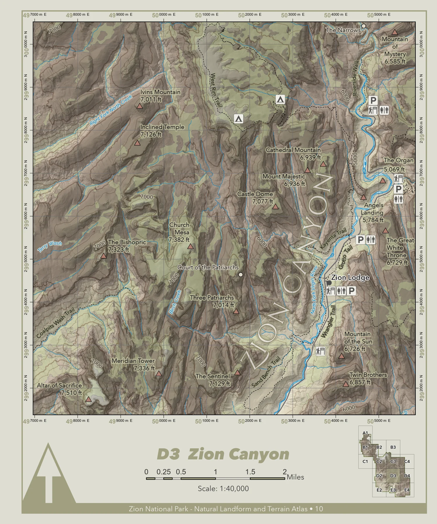
While it is not possible to display all of the park’s geographic features, this atlas includes a selection of major and well-known features, ensuring that the most significant elements of Zion’s natural environment are represented.
Technology Stack
- ArcGIS Pro
Applied Skills
- Generated and refined a custom hillshade from a mosaicked digital elevation model (DEM) to enhance terrain readability and emphasize landform structure.
- Created a custom map series by subdividing a large geospatial image into indexed map plates with consistent layout, overlap, and spatial continuity.
- Applied varying generalization techniques to road networks and rivercourses to improve cartographic clarity and project performance.
- Designed and produced a small-format atlas according to defined cartographic production specifications, including page dimensions, usable map area, margins, bleed, and layout consistency.