Project Files & Links
About the Project
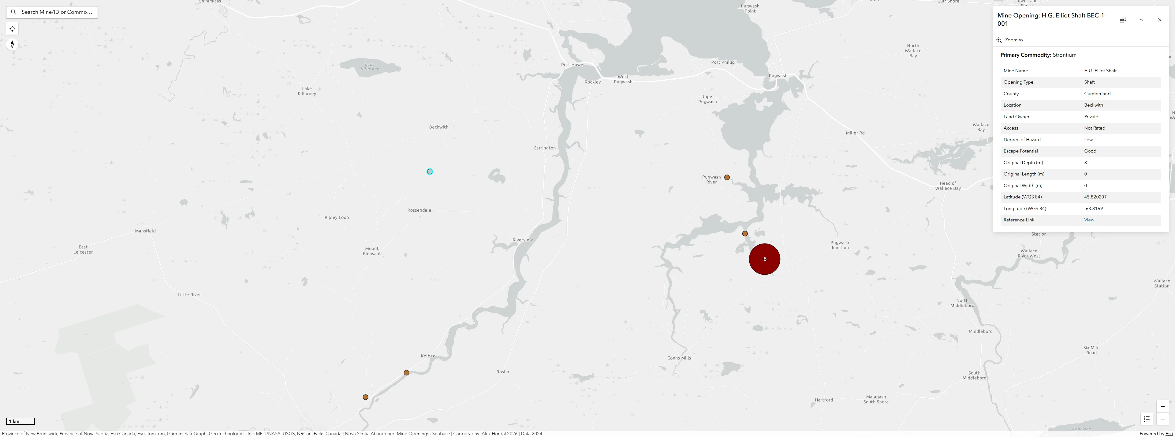
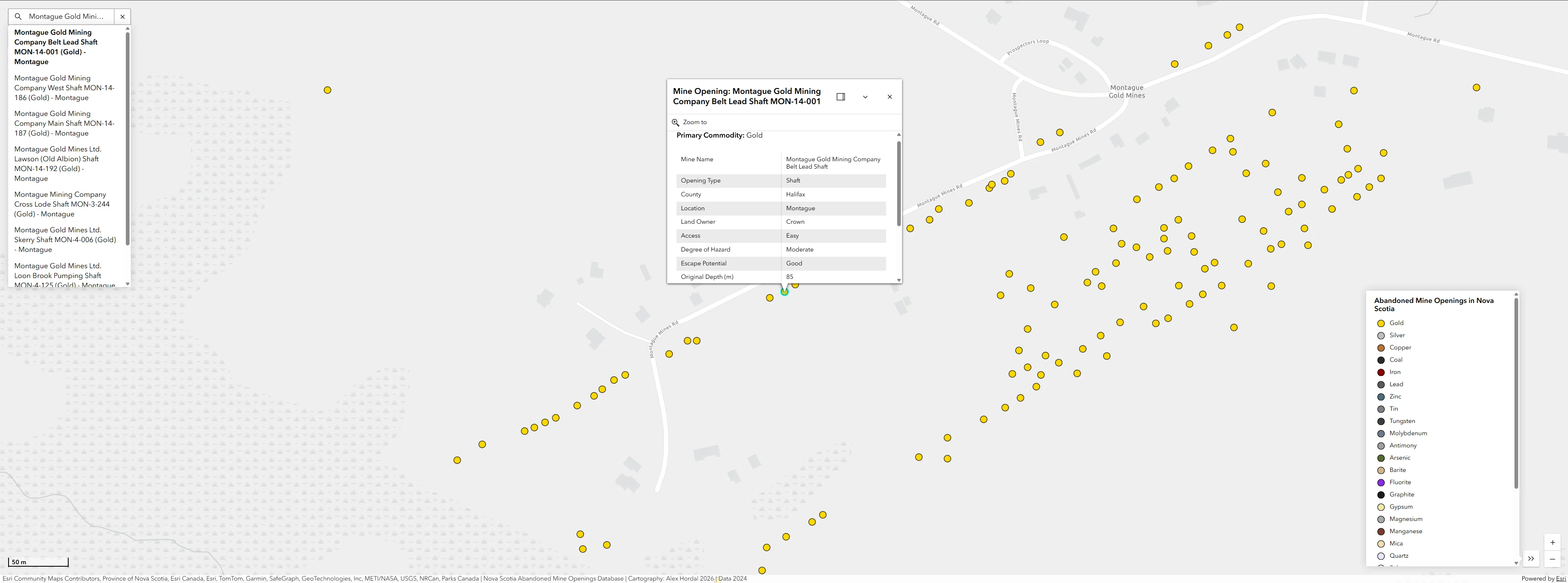
This project involved designing a JavaScript-based interactive web map visualizing the locations and primary commodities of 8,565 abandoned mine openings across Nova Scotia. Built using the ArcGIS Maps SDK for JavaScript and the Calcite Design System, the application uses GeoJSON datasets to deliver a fully responsive web mapping experience that allows users to browse mine openings spatially or search by mine name and primary commodity.
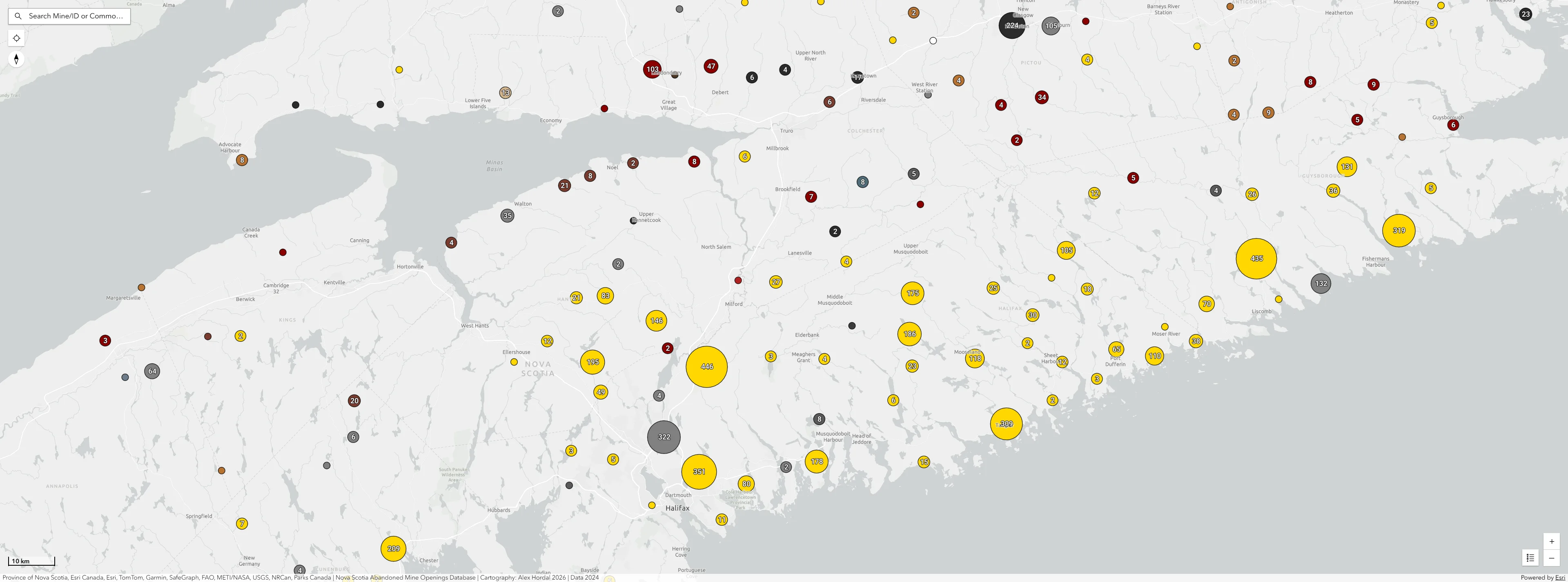
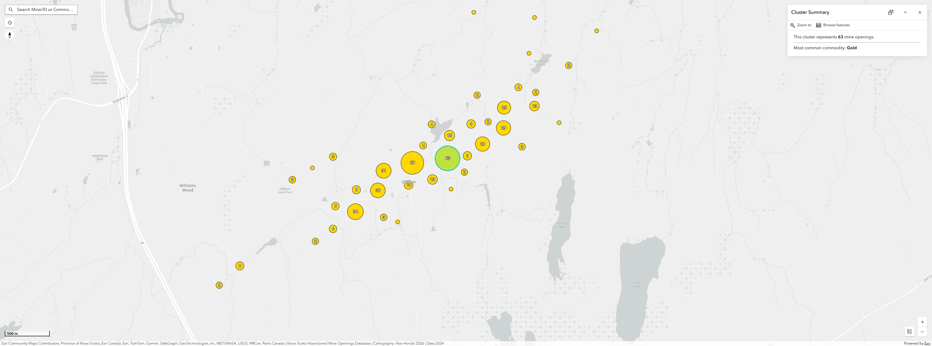
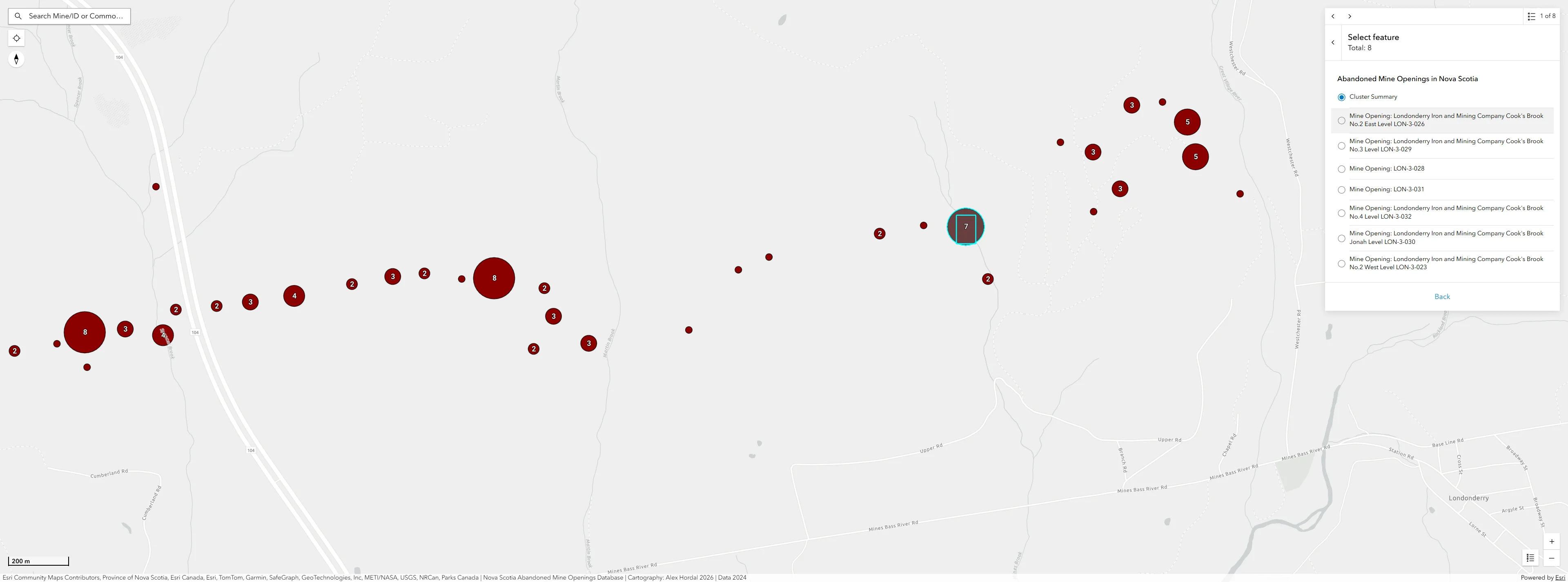
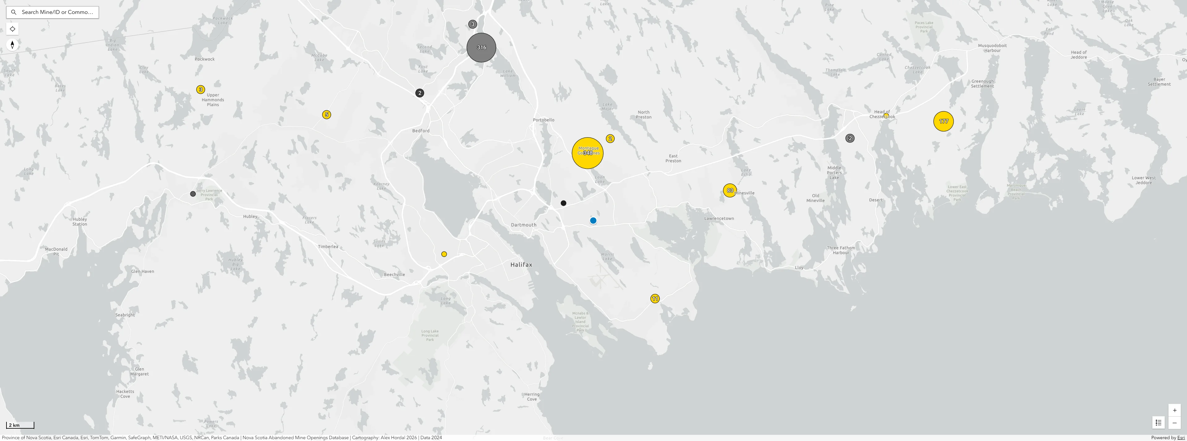
The application was developed using HTML, CSS, JavaScript, and ArcGIS web components, with ArcGIS Pro used for initial dataset preparation and GeoJSON generation. Marker clustering workflows generalize thousands of mine openings into proportionally sized circles symbolized by the dominant commodity, allowing the map to remain readable and performant across multiple scales. As users zoom in, clusters expand to reveal individually symbolized mining nodes.
The project emphasized responsive interface design and event-driven JavaScript workflows. Contextual menus provide mine details at both the cluster and individual feature level, while a dynamic legend references commodity types symbolized throughout the application. Additional interface components—including search, popup, legend, scale bar, and locate tools—were implemented using the ArcGIS Maps SDK and Calcite Design System.
This project strengthened my understanding of client-side web GIS development, interactive cartographic generalization, GeoJSON data management, and responsive web application design within a modern JavaScript mapping environment. It also reinforced workflows involving clustering logic, user interaction handling, and scalable symbolization techniques for large geospatial point datasets.
Technology Stack
- HTML
- CSS
- JavaScript
- ArcGIS Pro
- ArcGIS Maps SDK for JavaScript
- Calcite Design System
Applied Skills
- Implemented marker clustering workflows to maintain readability and performance across large geospatial datasets.
- Applied cartographic generalization principles across multiple zoom levels.
- Built a responsive user interface using Calcite Design System components.
- Developed event-driven JavaScript interactions for clusters and individual mine features.
- Loaded and managed GeoJSON datasets within a web mapping environment.