About the Project
This project involved designing a four-map emergency response series in ArcGIS Pro to support a fictional train derailment scenario in the Windsor Junction area of the Halifax Regional Municipality (HRM). The project focused on emergency planning, evacuation analysis, and response accessibility using a combination of spatial analysis and cartographic visualization techniques.
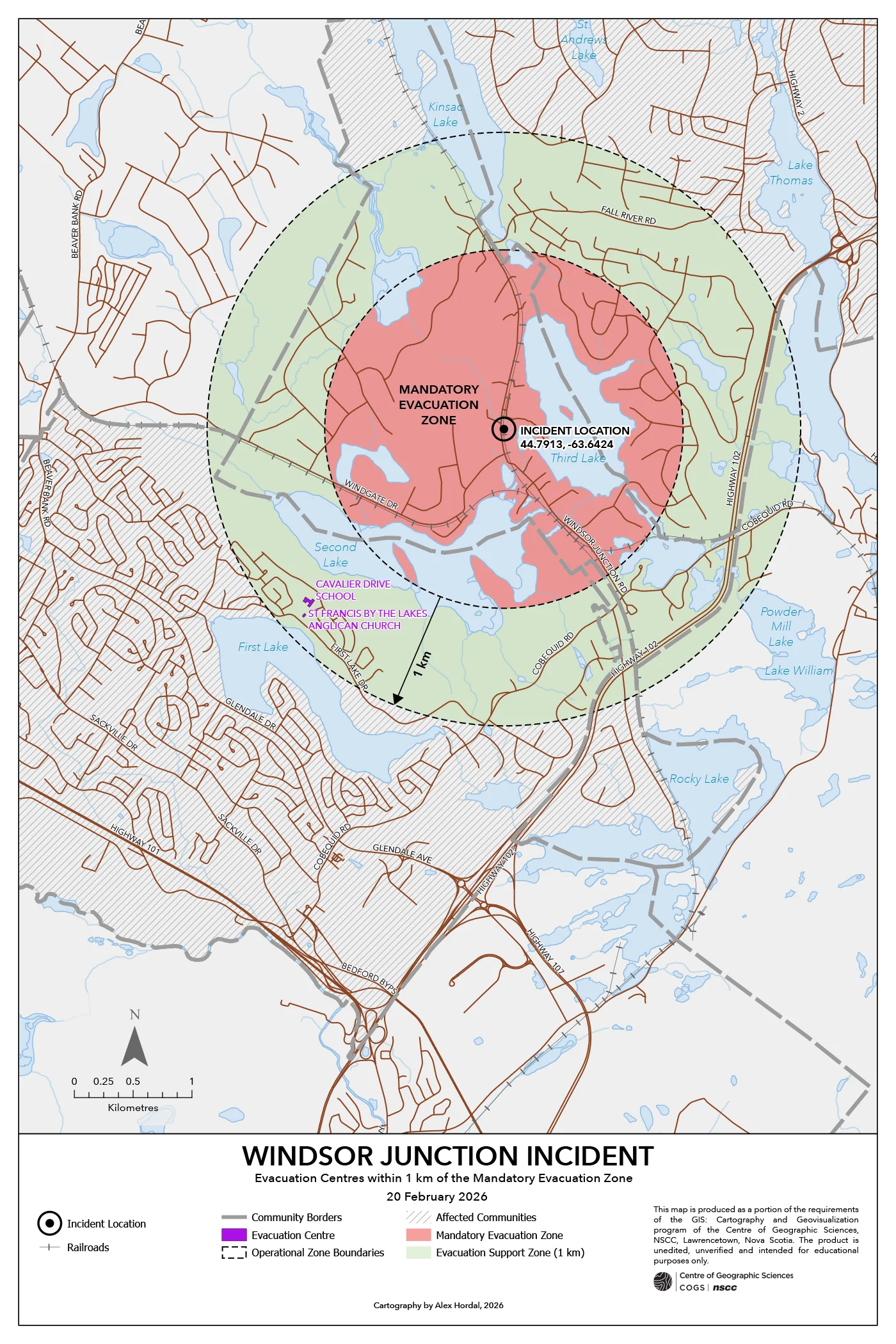
The first map established a 1,524 metre mandatory evacuation zone and a 1 kilometre outer support buffer surrounding the incident location. Buildings intersecting these hazard zones were identified using spatial selection workflows and symbolized according to land-use classification to support rapid interpretation of affected infrastructure and population exposure.
The second map isolated viable evacuation centres located outside the primary hazard area using attribute queries and location-based filtering. This workflow emphasized the practical application of spatial querying and emergency suitability analysis within ArcGIS Pro.
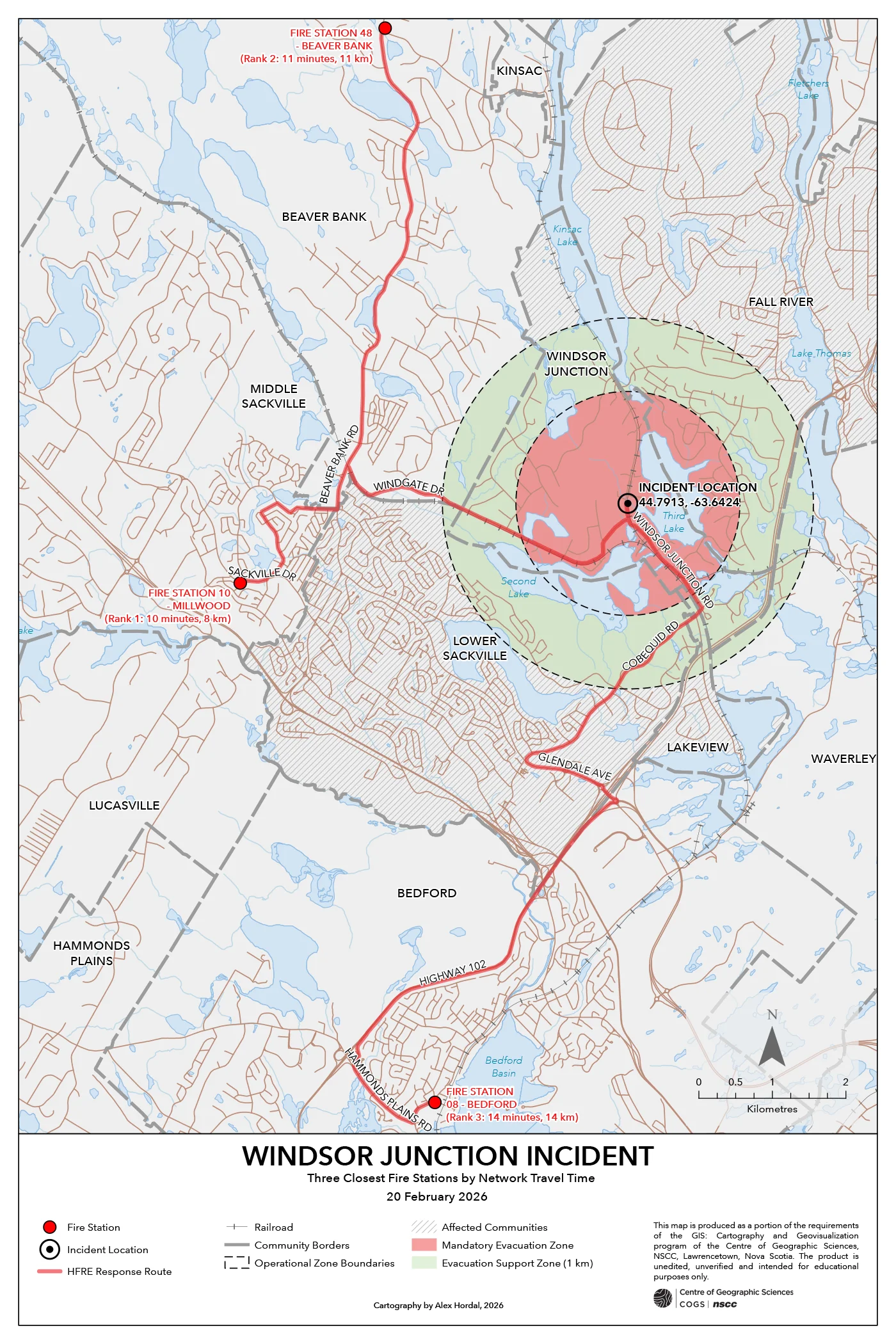
The third and fourth maps incorporated ArcGIS Pro’s Network Analyst – Closest Facility tool to identify the three nearest fire stations and hospitals relative to the incident location. Network-based travel distances and estimated response times were calculated and visualized to assess emergency accessibility and medical response capacity.
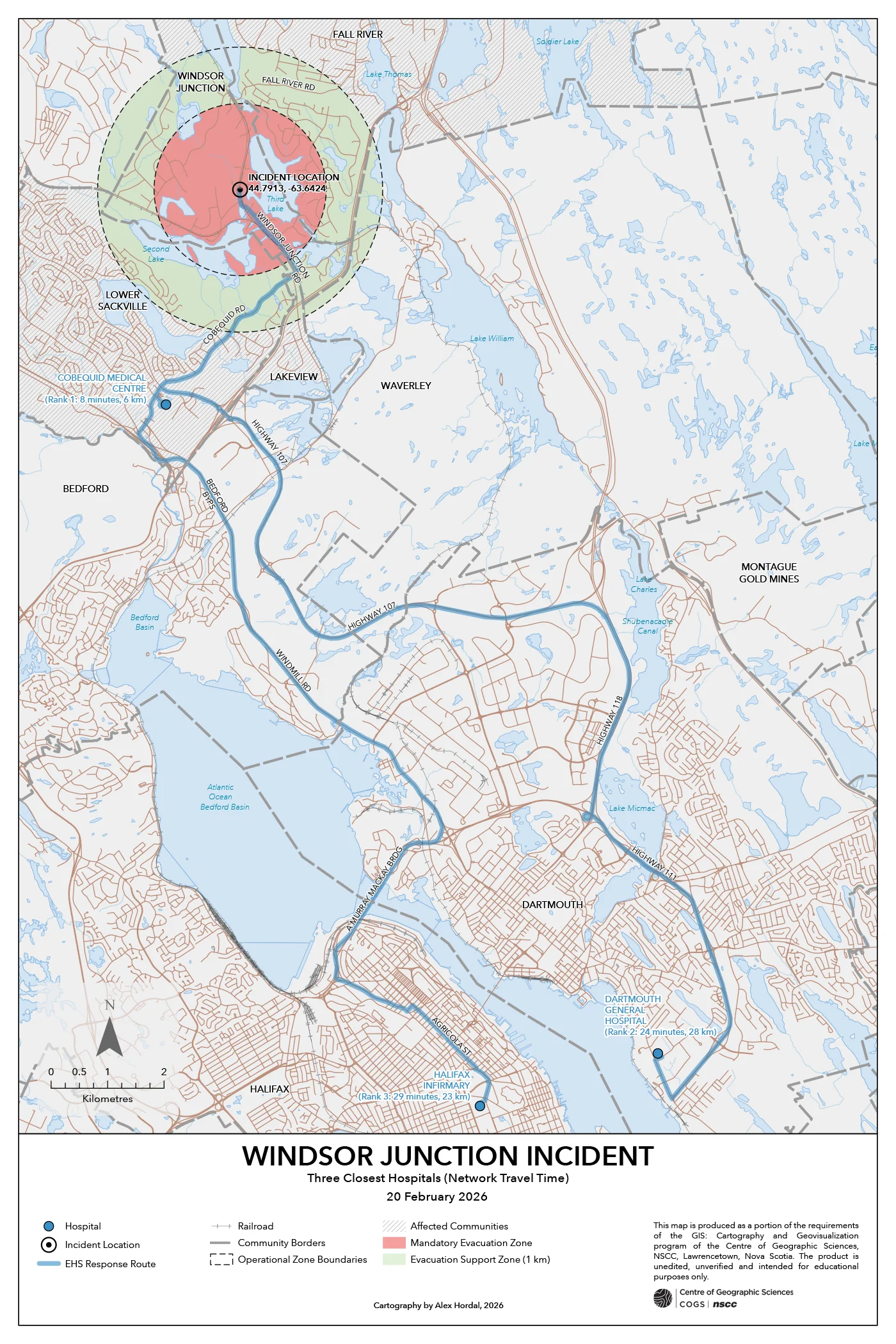
Cartographic design decisions focused heavily on visual hierarchy and clarity under emergency mapping conditions. Hazard zones, support buffers, evacuation infrastructure, and response routes were symbolized using distinct colour and line-weight hierarchies to ensure rapid visual interpretation. Feature simplification and symbol refinement techniques were also applied to preserve legibility in dense urbanized areas surrounding the incident site.
Technology Stack
- ArcGIS Pro
Applied Skills
- Applied buffer analysis and spatial selection workflows to delineate evacuation and support zones.
- Used structured attribute queries and spatial filtering to isolate viable evacuation centres.
- Applied ArcGIS Pro Network Analyst (Closest Facility) to calculate emergency response distances and travel times.
- Applied feature simplification and symbol refinement techniques in high-density impact areas.
- Designed symbol hierarchy to distinguish hazard zones, support buffers, and emergency infrastructure.