Project Files & Links
About the Project
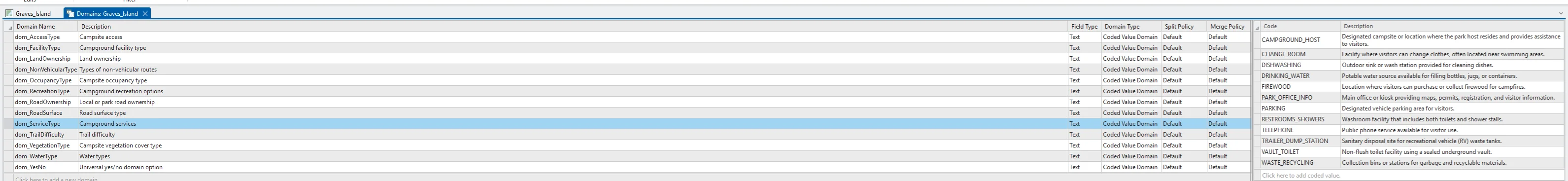
This project began with georeferencing an existing campground map of Graves Island Provincial Park and transforming it into a fully digitized geospatial dataset within ArcGIS Pro. Shorelines, contours, campsites, roads, trails, and recreational infrastructure were manually digitized into structured geodatabase feature classes, while custom coded-value domains were developed to classify campground infrastructure and improve attribute consistency throughout the project.
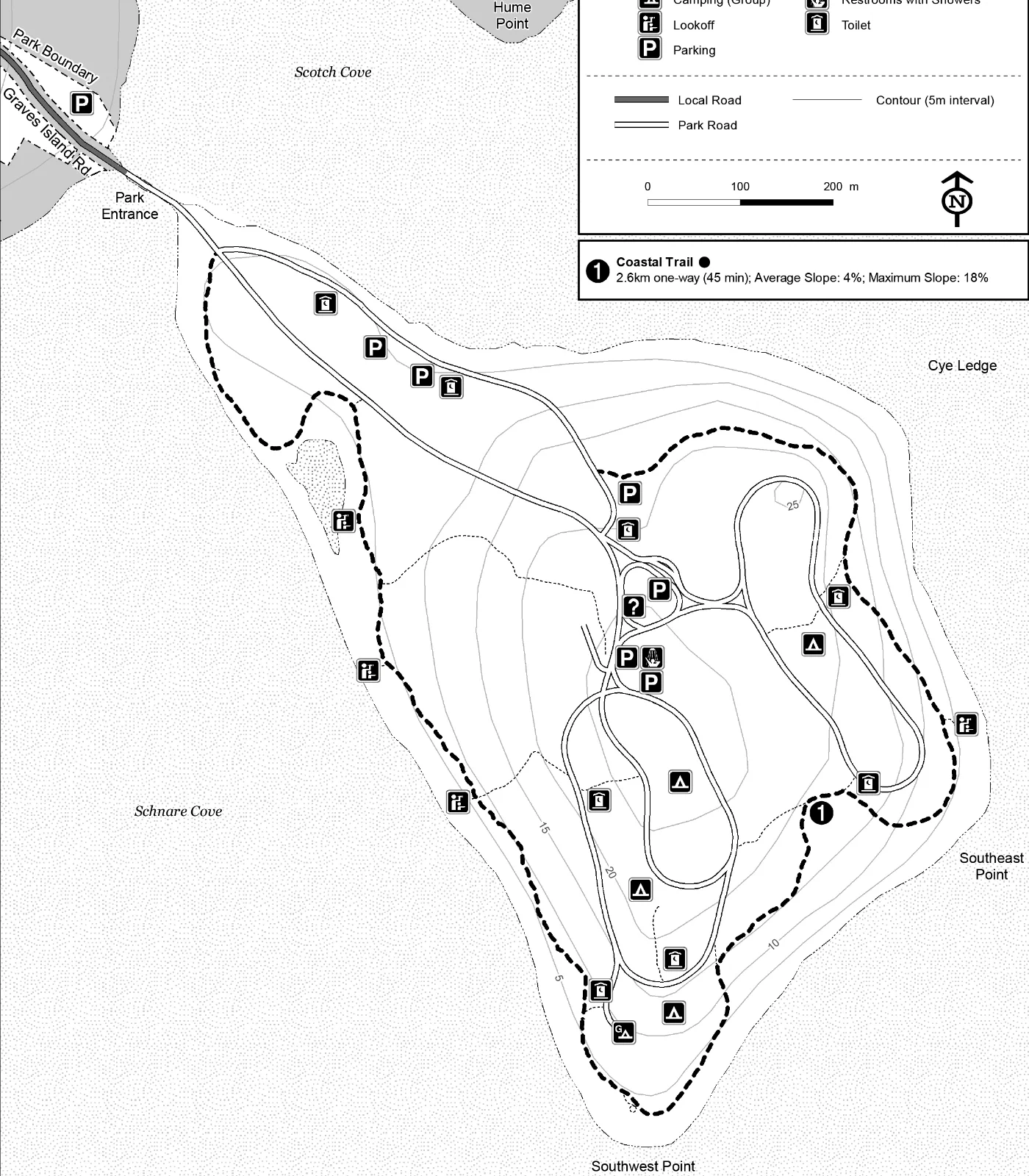
Once the spatial database and basemap were completed, the layout was exported from ArcGIS Pro into Adobe Illustrator using the AIX workflow. Three distinct thematic versions of the same map were then developed through variations in colour palette, typography, and overall cartographic styling, including a modern four-process design, an achromatic-plus-one historical style, and a complementary-colour rustic theme.
The finalized maps were then imported into Adobe InDesign for poster composition, layout refinement, and final presentation design.
Technology Stack
- ArcGis Pro
- Adobe Illustrator
- Adobe InDesign
Applied Skills
- Georeferenced and digitized a pre-existing campground map to create an accurate spatial foundation for cartographic redesign.
- Developed three distinct cartographic themes exploring the influence of colour palettes, typography, and visual hierarchy on map interpretation.
- Refined and standardized recreational symbology, labelling, and layout composition across multiple stylistic map variations.
- Applied cartographic design principles to balance readability, aesthetics, and thematic consistency within each map version.
- Integrated ArcGIS Pro, Adobe Illustrator, and Adobe InDesign workflows to support GIS processing, vector refinement, and final poster production.